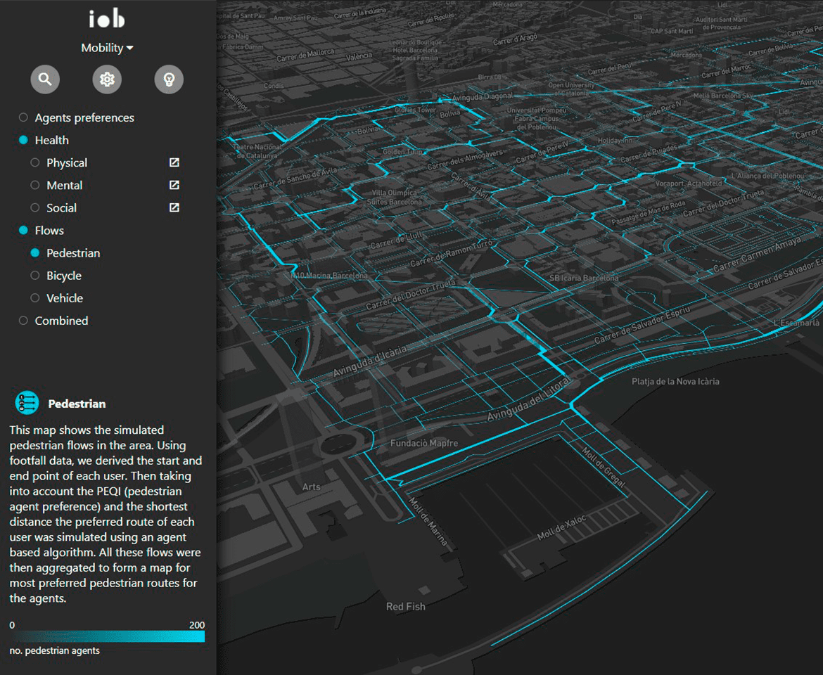
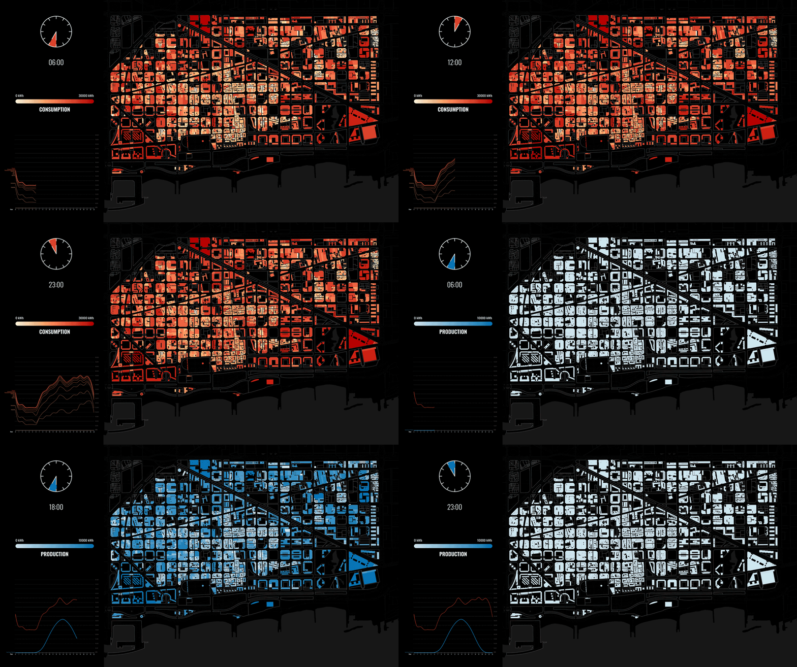
"Healing Flows" is a research project that aims to tackle the challenge of creating a healthy mobility network in our cities. To tackle this challenge, our project allows stakeholders and planners to design a catalogue of targeted interventions that promote healthier streets, through a combined agent-based evaluation of health risk and mobility flows on urban streets. As a result, we are able to identify each segment with a health score, based on three categories that pose threats to the the agents health: physical, mental and social health risk.
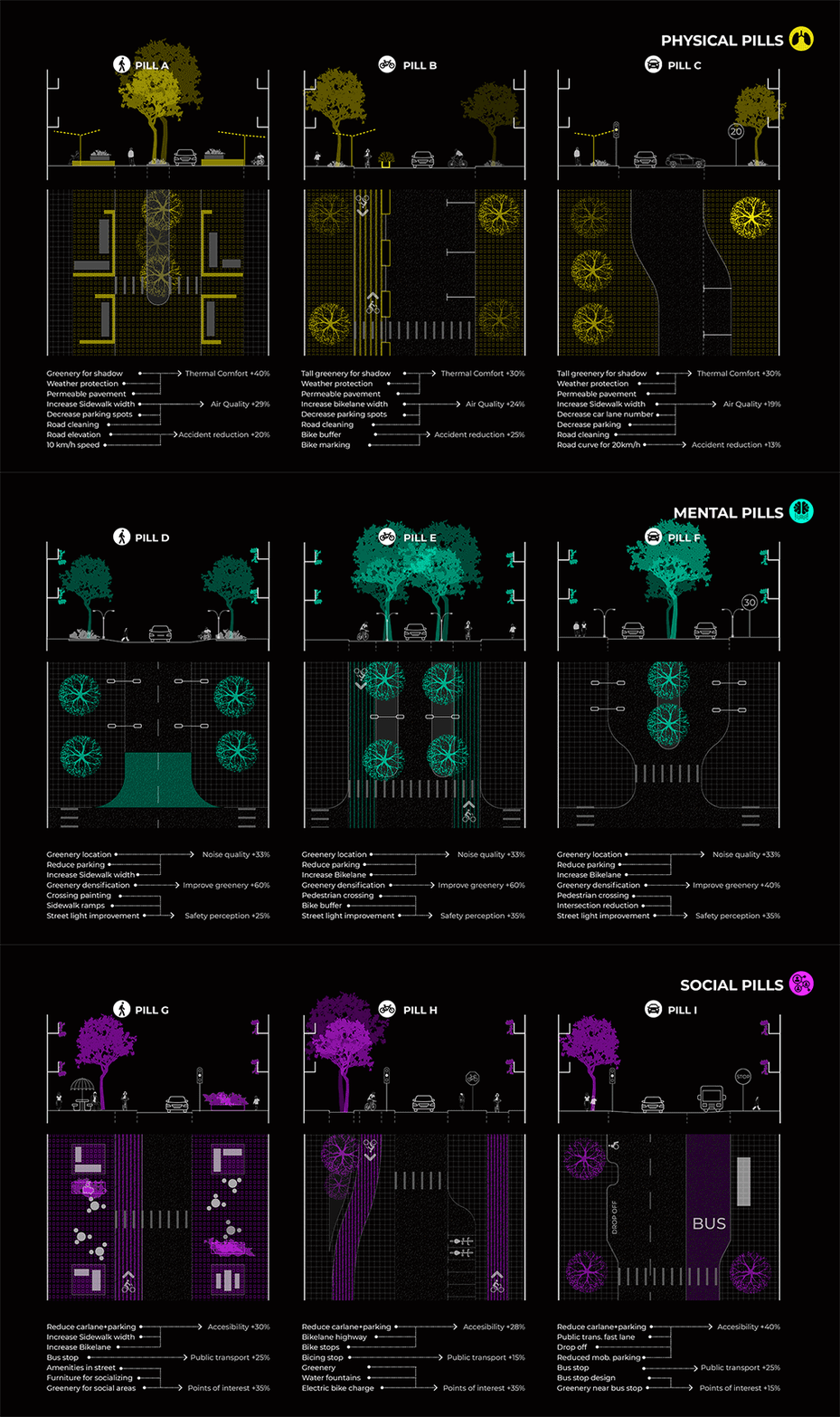
After selecting targeted segments, a catalogue of “Health Pills”, organized in 3 lines of action (sustainability, inclusion and comfort) associated with previous health score, are introduced and customized as interventions on the urban environment. The system allows the design input to be re-evaluated to understand its impact on the global network, so the final desired output could be obtained through this data-driven feedback loop.
Scope_01 Challenges
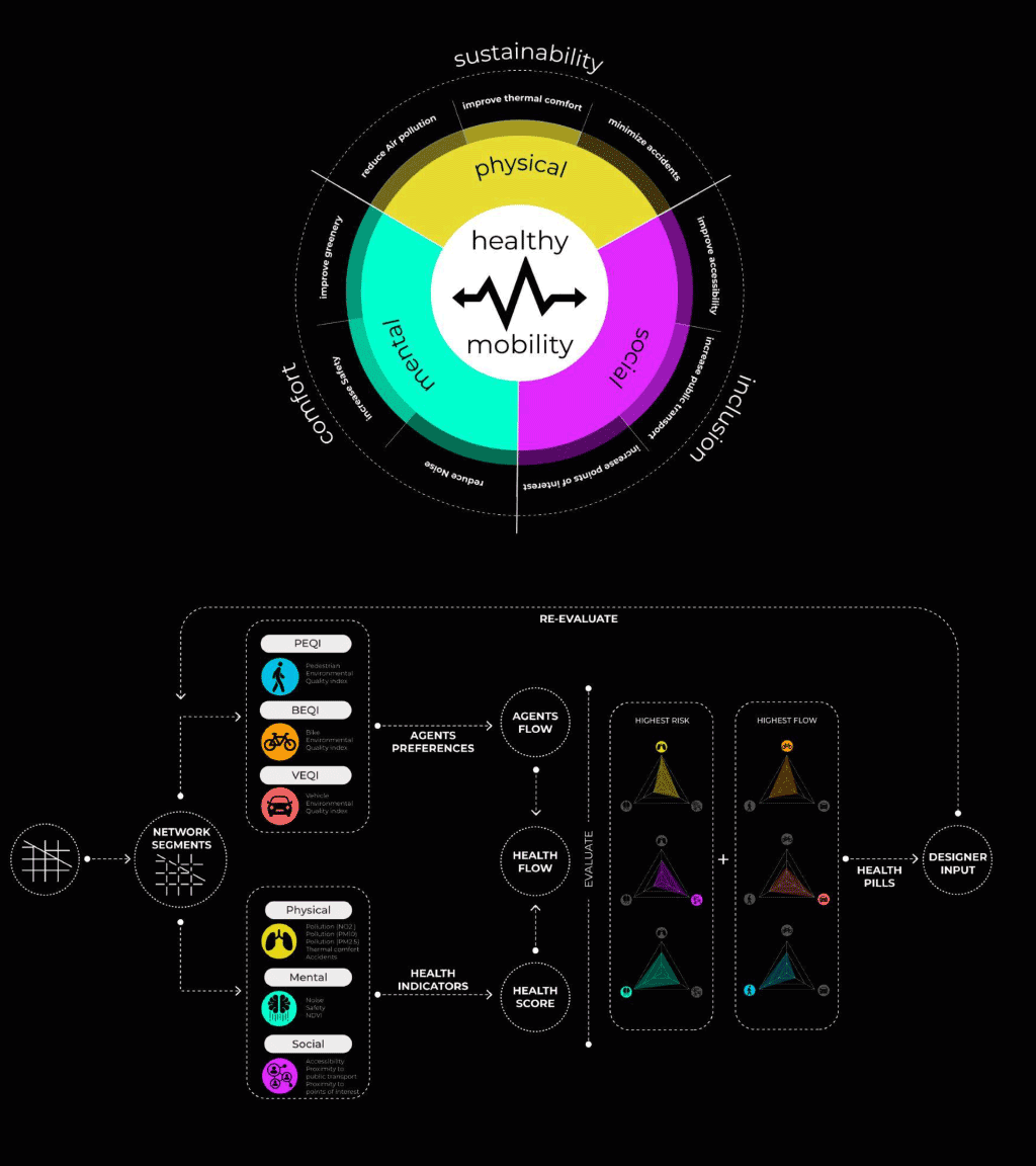
Scope_02 Analysis
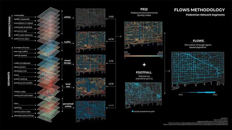
Scope_03 Simulation
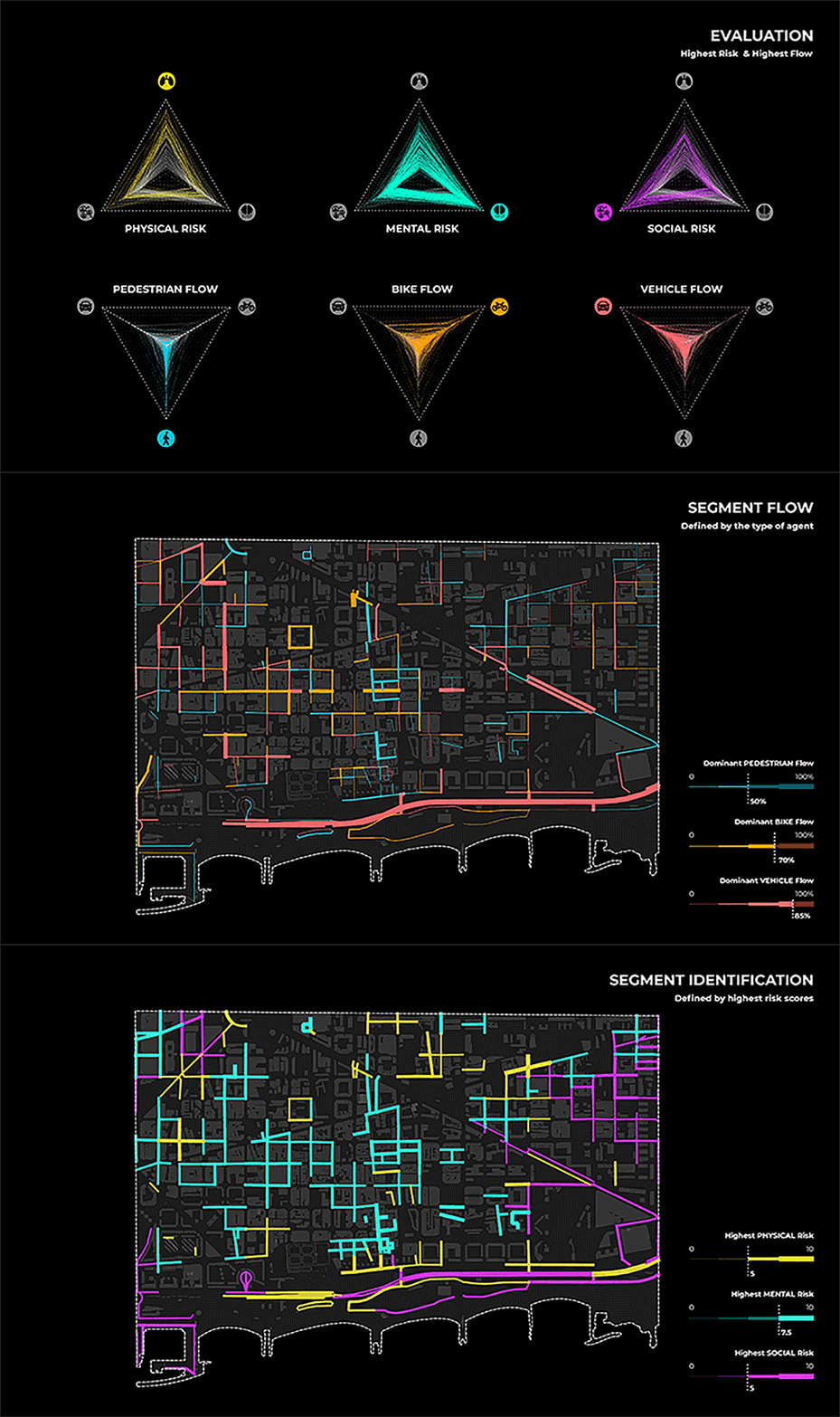
Scope_04 Strategies
"Healing flows" is a project developed at IAAC, Institute for Advanced Architecture of Catalonia, by: Tugdual Sarazin, Adriana Aguirre Such, Diana Roussi, Dongxuan Zhu & Hebah Qatanany.

